Earn College Credit. Explore Geospatial Technology. Shape the Future.

The High School GIS Certificate is a 9-credit-hour college credential that allows high school students to earn college credit while exploring one of today's fastest-growing technology fields: geospatial science.

Offered through a unique partnership led by the University of Missouri–St. Louis (UMSL) in collaboration with Saint Louis University (SLU), Harris-Stowe State University (HSSU), and Lindenwood University, this program creates an early pathway from high school to college and future careers in geospatial technology, GIS, remote sensing, mapping, data science, and geospatial intelligence (GEOINT).


Program Information

Program Information

Credential

Total Credits

Lead Institution

University Partners

Delivery Model

Launch

Target Audience

Details

High School GIS Certificate

9 College Credit Hours

University of Missouri–St. Louis

SLU, HSSU, Lindenwood University

Dual Enrollment / Early College Credit

Fall 2026 (pending approvals)

High School Students (Grades 10–12)


Take the next step

Request more information below:

Loading...
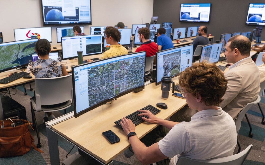
GIS student working at a computer with a large monitor showing a color-coded map and data analysis.

Why Geospatial?

Geospatial technologies help answer important questions such as:

  • Where is something happening?
  • Why is it happening there?
  • How can location-based data improve decision-making?

Today, geospatial technologies support numerous industries, including:

  • National security and defense
  • Emergency management
  • Environmental monitoring
  • Transportation and logistics
  • Urban and regional planning
  • Agriculture and natural resources
  • Infrastructure and utilities
  • Public health
  • Data science and artificial intelligence

College and Career Pathways

This certificate serves as a stackable credential that can support future study in:

  • GIS and Geospatial Science
  • Geomatics
  • Remote Sensing
  • GeoAI and Data Science
  • Environmental Science
  • Civil Engineering
  • Urban Planning
  • Computer Science
  • Geography
  • Public Safety and Emergency Management

Credits may apply toward future degree and certificate programs according to institutional transfer policies.

Professional Engagement Opportunities

Students may have opportunities to participate in:

  • Guest lectures from industry professionals
  • Geospatial career exploration activities
  • Internship pathway briefings
  • Applied geospatial projects

Students must successfully complete three courses (9 credit hours) to earn the High School GIS Certificate.

Required Courses (6 Credits)

University of Missouri–St. Louis (UMSL)

GIS 1000: Exploring Geospatial Thinking and Technology (3 credits)

Attach the Course flyer (provided)

Lindenwood University

GEO 20400: Remote Sensing (3 credits)

Attach the Course flyer (provided)


Select One Additional Course (3 Credits)

Option 1: Saint Louis University (SLU)

GIS 2010: Introduction to Location Science

Attach the Course flyer (provided)


Option 2: Harris-Stowe State University (HSSU)

GEOG 0401: Geographic Information Systems

Attach the Course flyer (provided)

All majors must meet the general education requirements of the university in addition to completing degree-specific curriculum requirements.

Review Full Degree Requirements

Non-Missouri Residents: Prospective students are responsible for reviewing the NC-SARA state authorizations page to see if this program is offered in their state throughout their program and to review the licensure or certification requirements for the state in which they reside.

UMSL Geospatial Collaborative

Program Leadership

Dr. Reda Amer

Director, UMSL Geospatial Collaborative

University of Missouri–St. Louis

 https://www.umsl.edu/geospatial/index.html

 reda.amer@umsl.edu

314-516-4838


UMSL Advanced Credit Program (ACP)

The UMSL Advanced Credit Program serves as the central administrative hub for dual-credit enrollment, eligibility verification, and transcripted college credit processes.

High School GIS Certificate Coordinator

Mr. Bradley Griggs

https://www.umsl.edu/acp/

acp@umsl.edu

mgvd8@umsl.edu

(314) 516-7005

 Ready to Get Started?

For Students

Explore college-level geospatial learning while still in high school.

For Parents

Help your student earn college credit and discover exciting STEM career pathways.

For School Counselors

Expand opportunities for students through a structured college and career pathway.

For School Districts

Partner with regional universities to bring geospatial education into your schools.


Apply Now


Request Information


Partner Your School


Contact UMSL ACP

MORE Flexibility. MORE Possibilities.

When it comes to your education, we know one size doesn’t fit all. Offering exceptional academics at the undergraduate, graduate, and doctoral levels, our degree programs are built to fit any schedule. Whether you want to earn your degree on campus, fully online, during the evening or weekends with our 4-, 8-, 12- and 16-week course offerings – UMSL will meet you when and where you want.

UMSL Rankings

#1

in Missouri for affordability
(Business Insider)

#11

Nationally for Online Bachelor's programs
(US News)

60+

non-degree certificate programs

#1

transfer destination in St.Louis

#5

nationally for adult education
(Great Value Colleges)

umsl tritdent

Discover UMSL

Get started today

Discover more at UMSL! Join a vibrant student community and gain access to world-class researchers, top-ranked degree programs and sought-after internship opportunities.